- E:info@trigeo.ai
3D LiDAR Point Cloud Annotation
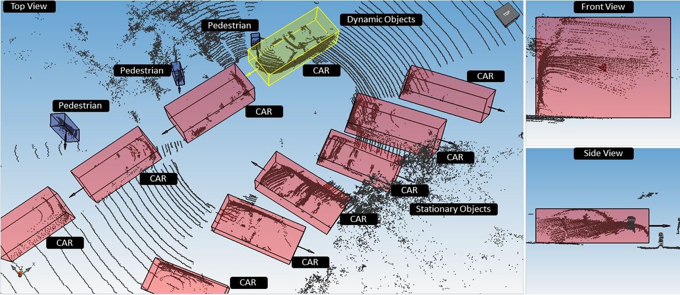
3D Point Cloud Annotation is used to detect and visualize the objects that are labeled for more precise detection and classification for right dimensions and to track labels with high accuracy.
Capabilities
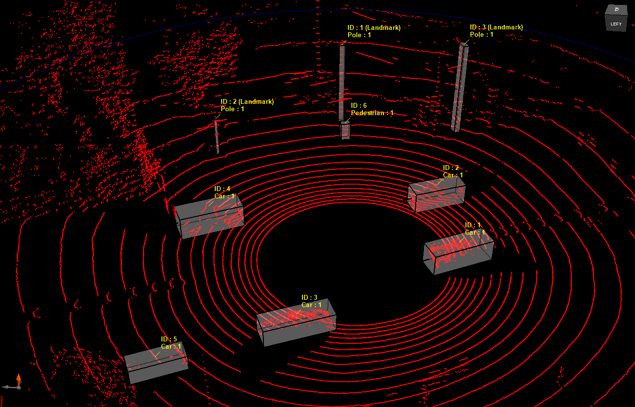
Object detection & tracking with 3D boxes - Get size, location, speed, pitch, yaw, heading and tracklets of objects accurate up to 1 cm with 3D boxes. Get 3D orientations including roll, pitch, yaw and heading along with class, dimensions and tracking label at high accuracy. Our class list is exhaustive and ever-growing. Object Classification - Classify each identified with additional attributes relevant for perception model to learn. Lane detection - Polylines to distinguish various lanes in 3D point cloud map. Lane detection to annotate road demarcations for safe driving.
2025 © TriGeo Technologies, All Rights Reserved.